|
FLOOD RISK
HOME | A-Z INDEX | MEMBERS | MPS | OFFICERS HOME | AFFORDABLE | CLIMATE | DEVELOPERS | ECONOMY | FLOOD | HISTORY | HOMES LADDER | MORALS | POVERTY | PROPERTY | SLAVERY | TAXES | SLUMS | VALUATIONS | WEALTH
|
|
|
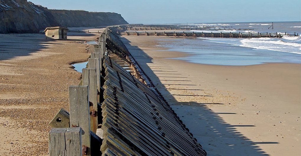
Climate change is increasing the risk of floods as melting ice causes the sea level to rise, releasing more water into our atmosphere - so increasing evaporation and precipitation cycles - meaning more rain in some geographical locations. You may have noticed that we no longer have snow for Christmas. We just get wet.
The increased risk of flooding means less land is available to build on safely, so reducing the amount of land for affordable housing, but making it even more important that we do something about reducing our carbon footprint right now before it is too late.
AFFORDABLE HOUSING
Truly affordable housing is also climate friendly. During WWII when we needed low cost housing to accommodate the work force for less money we built smaller units like those at Pevensey Bay in Sussex. Though this was supposed to be a temporary measure, those pre-fabricated units are still in existence today and offer some of the best value housing around.
THE
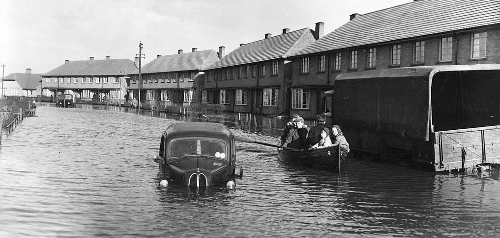
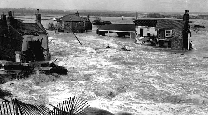
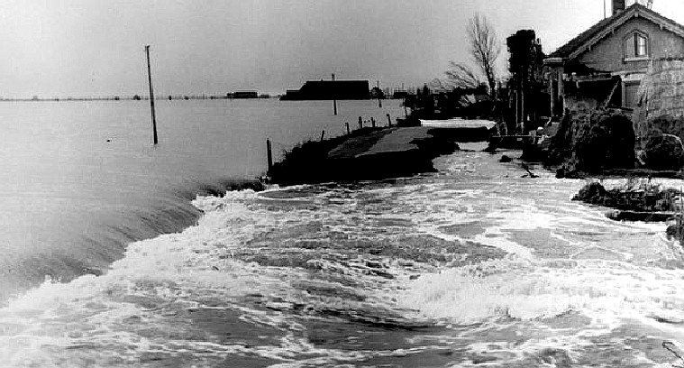
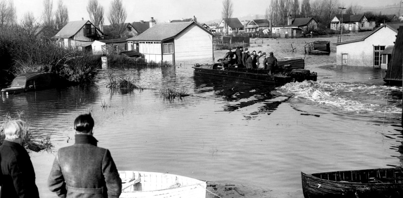
BIG FLOOD OF 1953
Exceptional weather conditions, coupled with poor communications, meant that whole communities were given insufficient warning of the advancing threat.
Today, nearly one million homes and businesses in England and Wales are at risk from coastal flooding. However, the risk of a disaster on the scale of the 1953 floods has been significantly reduced due to the millions of pounds spent on flood defence and warning systems.
In 1953 there was no national flood warning service or coordination. Flood defence was organised by a number of river boards. They had emergency plans but were not linked on a national basis. Emergency plans were hampered by communications failures in most locations.
The existence of proper flood warnings and communications would have greatly reduced the loss of life by allowing time for communities to be evacuated.
Following the floods, the Waverley committee was set up to report on the disaster and consider schemes to protect London. This led to the erection of the Thames Barrier, the world's largest moveable flood barrier, in 1982. It protects London and the upper reaches of the Thames from tidal flooding. The Waverley committee also recommended that a national flood warning system be set up.
The Waverly recommendations resulted in the creation of the Storm Tide Warning service, today known as the Storm Tide Forecasting Service (STFS) and operated by the Met Office, which provides 24-hour forecasts of tidal surge and wave activity.
In 1989 the National Rivers Authority (NRA) was formed to oversee flood defence in England and Wales. Then, in 1996, the Environment Agency was created with overall responsibility for flood defence and flood warning.
When floods devastated large parts of the East Coast in 1953, Canvey Island in Essex was one of the places that bore the brunt.
The North Sea floods of 1953 claimed 307 British lives. In the Netherlands, the dead numbered more than 1,800.
HOMELESS LINKS
https://www.jrf.org.uk/housing/homelessness
HOME | AFFORDABLE | CLIMATE | DEVELOPERS | ECONOMY | FLOOD | HISTORY HOMES | LADDER | MORALS | POVERTY | PROPERTY | SLAVERY | WEALTH HOME | A-Z INDEX | MEMBERS | MPS | OFFICERS
|
|
|